Friday, October 18, 2013

Johm Muir Trail (part VI, THE END thank goodness!)

And so, after a brief period on Mt. Whitney summit we began our descent.

 Here's a shot looking back.  Whitney is the rounded non-peak-looking peak on the left (over the sheer rock rather than the scree that surrounds it). The pointy peak in the middle is Mt Muir, and the pointy peak to the right I have no idea if it's even named (looks bigger as it's closer to us).

 Here we are looking ahead, towards Trail Crest. Quite the scenic rock formations for sure.

We're past Trail Crest now, heading down the 99 switchbacks. That's Greg below me making great time. Me, I'm taking it EASY, doing my very best to NOT come down hard on either foot from the steps made from rock. I did that (came down too hard too often) on both prior Whitney descents, and I was almost crawling due to unbelievable knee pain well before I reached the bottom. I did NOT want to repeat that. In the center top of the picture you can still see Mt Whitney, the rounded peak.

Looking DOWN a pretty steep face, this is what the 99 switchbacks take us down. You can see many of the switchbacks below. I think that might even be Greg again WAY below me. It's about as barren as it can possibly be up here.


An easy section actually, but you can see the danger (if you were to fall/slip off to the left you'd have a very long slide to your death). That's a lot of work done LONG ago to put those posts and chains into the solid rock of the trail. And they had to blast/dig the trail through here..you can see what we are descending by the angle of the rock on the right side.

We've made good progress heading down. The green and trees in the far off middle is what we've been calling "Greg's Meadow" all these years. I've now passed Greg (he was hoping we'd camp at "Trail Camp" which is basicly a rocky spot where EVERYBODY camps at the base of the switchbacks. I had no intention of staying there if my legs were still working, so I continued down. My goal is to get us to Greg's Meadow. It's still a ways off, but seeing it gives me great hope. 

Just getting to the top of the tree line, you can see some of the higher Bristlecones. Also you can see how steep this valley is that we are descending.

xxx Lake. No camping allowed (darn it!) I would have easily stopped here if we were allowed. Alas, it was just a beautiful spot on the trail teasing us.

 And here is the far end of Greg's Meadow (we've hiked the length of it to get to here, and this is where we camped for our last night). This is the view from camp...not too shabby if you ask me!


I included this shot to show you how hardy the Bristlecone pines are. You can see these little guys are growing literally on the side of a cliff, probably rooted in a tiny crack. Somehow they can survive this kind of environment, which is just amazing! In the bottom to the left of the living tree you can see a dead one. It's a pretty harsh place to live for sure!

Just a shot looking back up the trail, we are getting close to Whitney Portal (the trailhead) now. The high peaks are WAY up this valley, from this view it's hard to believe what's in store for you as you ascend for the first time. You'd think it will just be green and beautiful everywhere, but it turns to sheer rock.

We MADE IT! And this is what's been on my mind for the entire hike down on our final day: a Whitney Burger! I can't tell you for sure if it's the best burger on the planet (considering we've been eating freeze dried food for 4 days now)...but it sure is tasty! And those fries...OMG are they GOOD!! (the burgers are as big as they look too...quite a meal for some hungry backpackers!)

Looking back up Whitney Portal road, this is the view of Mt Whitney you get from the highway going thru Lone Pine. That's Whitney dead center, with Mt Muir the closest jagged 'tooth' peak to it's left. It doesn't look like the highest peak, but it's much farther back than the other mountains in the foreground. If you like to watch old westerns, then you've seen this view MANY times as they did a LOT of Hollywood filming in this area. All the restaurants in town are filled with signed pictures of the stars, movie posters, etc.

And this is a zoomed in shot of Whitney, our final view before we head home. There is a "Mountaineering route" that goes right up the face, but obviously that requires actual mountain-climbing skills with ropes, equipment and such. Nothing I'm interested in. I much prefer the "yellow brick road" approach used by tens of thousands every year. I won't be back up here anytime soon, that's for sure. But it was a great hike and we both ended it without any injuries, and our knees even held out very nicely. Goodbye Mt Whitney!

And so...that wraps up our backpacking trip. I can FINALLY write about something else (hooray, it's about time you are probably saying to yourself). 

Sorry it took so long to finish this, my life has been QUITE busy with the granite counter-tops these last few weeks. It's safe to say it has consumed my life. But they are finally in, the sinks are all in and working, the doors area ll back on the cabinets, and tomorrow (Saturday) we will order our cut stone for the back-splash's. I'll work on those when I can, no huge rush but I just want to get it over-with.

Cheers!

Wednesday, October 9, 2013

John Muir Trail (Part V: Mt Whitney Summit)

Day four (our third FULL day) on the trail begins as we awaken at Guitar Lake. We are just a few hours hike from Trail Crest (the top of the ridge which then takes you either to Mt Whitney OR down the other side towards Whitney Portal trailhead). The sun comes up over the eastern mountains around 8am, and we are up and moving, preparing for the day.  After another quick breakfast we break camp and are on the trail.


 That's Greg WAY ahead of me, having already passed the un-named tiny lake (above Guitar Lake). We are headed towards Trail Crest, which is the low-spot in the ridge almost directly above Greg in the sun-beams.

  Looking back towards the way we came (east), and Guitar Lake where we spent the night. The Onion Valley/Kearsarge Pass and Forrester Pass are all WAY WAY WAY back that-a-ways.
 
 The trail gets steep as we ascend towards the ridge. The land is quite desolate up here, nothing but rock.

  And there it is: Trail Crest! Hooray! Elevation: 13,600'. Greg has already passed that spot and has started towards Whitney Portal (thinking we were NOT going to summit Mt Whitney). However it's like 11am, what else are we going to do today? We aren't hiking out until tomorrow. So I set off after him, catching him at the top of the switchbacks. We discuss our options and decide that a Whitney summit is indeed in order. So we ditch our packs right there and grab what we need, and head off for the summit.


 This is the trail towards Whitney. I winds along the ridge, thru some breathtaking rocky scenes. Most of this trail you wouldn't want to fall off, as there is a long way down on either side. That's actually part of Mt. Whitney on the left...in this picture it looks like a giant scree field, and the wild rock outcrop in the middle of the picture is blocking the view of the summit.
 
 And now you can see Mt Whitney, along with Mt Muir. Whitney is again on the left, just above the solid rock face (very non-summit looking), where-as Mt Muir is the pointy outcrop in the middle of the picture (Mt Muir is also over 14,000 feet).
 
 Looking back the way we came, Trail Crest is seemingly forever back along the ridge. That is Mt Muir on the left (the outcrop). We are on the final ascent  towards the Whitney summit, heading up the humongous scree field which is the entire western side of the mountain. The eastern side is just a cliff (as you can see from Mt Muir).


 Looking down (zoomed in quite a bit) at the 99 switchbacks trail that descends from Trail Crest towards Whitney Portal. This part is where it isn't so steep, further up the trail (blocked by the peak on the right) is where the switchbacks go nearly straight up the face to the top of the ridge. We'll be on this section later today, trying not to destroy the knees as we descend with full packs.

 And here you see the final summit push. It's a very non-assuming summit, kind of a yellow-brick-road if you will. The rock hut was made long ago, and is a nice little shelter if you happen to be up here when it's cold (right now it's probably in the high 40's/low 50's. You can see the gathering of hikers at the "summit".


A better view of Mt Muir, and the trail heading back towards Trail Crest on the backside thru the scree field. Just above Mt Muir's peak (in the far background) is another peak sticking up, which is also very unassuming. It's more of a flat-top rounded thing, with the left side being slightly higher. That is Mt. Langley, which is also a 14'er. Greg and I summit-ed that one a few years back when we camped/hiked in the Golden Trout Wilderness.

And here is the obligatory summit photo. No, it doesn't quite have the same oomph as an Everest summit I know...but this IS the highest point in the continental United States. Elevation: 14,505'.

That will have to do it for today...I'm SO busy at home just now. Our granite counter-tops arrive on Monday, and to save us a thousand $$ I have been doing the prep-work myself (removing our old counter-tops). This involves not only removing them, but removing the old sinks (both master and guest bathrooms AND the kitchen) all the way down to the bare open cabinets. Then I set the plywood back on and set the sinks back in, and then finally hooking them back up again until Sunday night so we can live. Also I needed to remove the old backsplash (which tore up the drywall pretty good), so I've been working on that for a few days now. In fact, the reason I have some time tonight to work this new post is that I sprayed the "orange peel/knockdown texture" on the spackled/sanded areas that will be visible above the new backsplash, and it takes a while to dry before I can paint it...I'll do that (paint) tomorrow.

Along with the new counter tops we got all new sinks and faucets (the kitchen is a double-bay cast iron/enamel BEAST. If you've ever lifted one of those, you know what I'm talking about here). I also had to remove all the hot-water shut-off valves as they were all corroded open (had to shut off the whole house water supply at the street to do that). It's been quite a job, and I can't hardly wait until it's over. However it won't be quite over for a while yet...we still need to install new backsplash's (we didn't buy granite ones, we will put in our own using ceramic decorative tile). But we can't even really pick that out until the granite is in and we can color-match. I know it will be wonderful when it's all done.

Also I get to do all the new plumbing for all 4 new sinks/faucets. Good thing I'm kind'a handy around the house...though I must admit that plumbing is my 'weak spot' in home repairs.....you can't fake it...you actually have to KNOW things or you can easily make a situation into an emergency (when it involves water flowing somewhere into your house that you can't stop). You don't get points for trying in plumbing, that's for sure. But so far, so good (no emergency plumber calls...yet).

And so...have a great week/weekend! Summer is past, Halloween is coming FAST! After that it's all downhill into the cold and winter, darn it. Come on SPRING!

Cheers!


Thursday, October 3, 2013

John Muir Trail Part IV

Day 3.

We left our high-altitude camp (about 2 miles south and 1000' below Forrester Pass) and were immediately descending towards Tyndall Creek. The sun was out and there were only a few tiny clouds in the deep blue sky. The temperature was decent...after then sun came up it warmed quickly and we were able to drop the long pant legs and long underwear tops soon after we had started hiking. We had a long way to go today, our goal is to get as close to Trail Crest pass as possible for tomorrows climb up to Mt Whitney and then descend part way down towards the Portal. I had my eye on Guitar Lake, which is only about 3 miles from Trail Crest summit, which would give us a 14 mile day (we have no significant passes to climb today so I was expecting our pace to be higher). We were both feeling pretty good, the high altitude hasn't been a problem since we woke up at Kearsarge Lake. Our legs were doing better now too...turns out backpacking/hiking is significantly different than pedaling a bike. Which was working to my advantage...Greg is INFINITELY stronger than I on the bike right now (and for the last 2 or 3 years). However I was matching him step for step now, and even pushing him for longer distance later in the days up here on the trails. It felt good to be beating up on him for a change...as it's been a LONG time since there's been any of that! (and no, we're NOT competitive...at ALL).

Here the trail descends towards Tyndall Creek. We are still about 12,000' right here.

 Heading in to the bristlecones, down near 11,500'. Our trail is on the left of the picture.

 Greg at the base of a dead bristlecone. They are like statues, and the wood is nearly as dense as stone. When branches fall they lie on the surface and don't rot..the trees grow SO slow that the rings are SO close together that the wood can just lie on the surface for centuries. Even the dead ones will stand until their supporting dirt/rock finally erodes away.

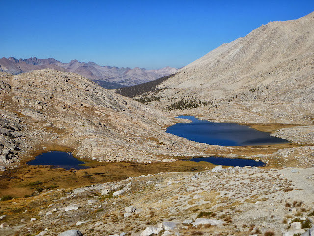
 An unnamed little pond in a high altitude plateau...we are back near 12,000' 
again on this unworldly landscape.

That's me out pushing the pace (Greg's camera battery died on day 1, and he kept wanting me to take a picture of this rock, that tree, that pond, this stick (well, maybe not the stick)...and I was in full-on MOVE IT mode...so I finally tossed him the camera and said "go for it".

 The trail just goes and goes...we descend again into the treeline from the surface of Mars. It's amazing how many landscapes you can see in one day of hiking. I've got my mind on making Guitar Lake, and nothing is going to stop me.

 And once again we are hiking the edge of a beautiful clearing. It wouldn't have surprised me a bit to see bears down here, but we didn't' see a single track or evidence that any were around.I could see them rolling over logs looking for bugs in this area. But except for some deer it was just us.

 That's me next to a couple of bristlecone statues (you can see on the left how vibrant they are when totally alive). No idea what killed these 2 (well, 3...you can see the third dead-one peeking into the picture on the right) smack in the middle of a beautiful bristlecone forest. There were only a few dead ones, and they were scattered far and wide.

 Now we're in the thick of it...sharp contrast to earlier in the day back near Forrester Pass!

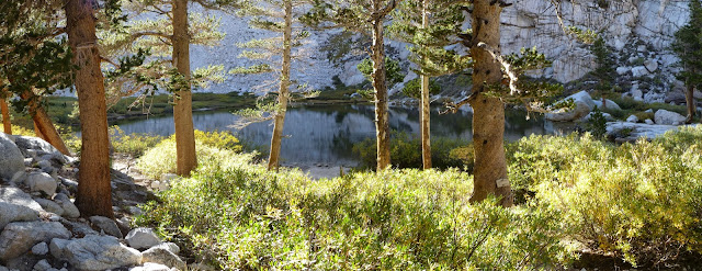
We came upon this wonderful meadow that I have chosen to call "Matt's Meadow". On the hike up from the Portal to Whitney there is a very similar meadow that Greg has claim to. You can see our trail in the shadows just below the trees on the right. What a lovely spot!

 We're getting close now...I believe this is Timberline Lake (there's a "no camping" sign, or we'd have stayed there). We still have a mile or more to go though, up above the timberline AGAIN.


 And here we are: Guitar Lake. There were already a decent size group (or groups) of people camped down by the rocks near the lake...so we stayed up on this little plateau overlooking everything. The creek that feeds the lake is on the left just a hundred yards or so for our evening water supply, and we had a nice little campsite in a small area of large rocks, giving us some protection from the wind (not that it was bad). We're back to about 12,000'elevation here.

And one of the last pictures of the day: the sun setting over the northern peaks, giving us their shadow on our southern mountains (and the moon is out). Trail Crest Pass is the little notch/low-spot below and to the right of the moon (about half-way between the moon and the right edge of the picture, then go straight down). If you then follow the ridge to the left from Trail Crest there are 3 little jagged peaks sticking up just about in the middle of the picture, then the next one is a rather unassuming peak  (seems lower than the jagged ones but it's not) which I believe to be Mt Muir (also a 14er), and then the next one which has it's peak hidden by the rocky ridge is Mt. Whitney. The view of Muir/Whitney from the backside (western side)  is quite the opposite to their eastern side, which is straight down cliff. From the back they gently climb thru oodles of large rubble until suddenly you are at the cliff/peak summit. The trail to Whitney summit goes right past that notch between Mt Muir and Mt Whitney...looking thru the gap is enough to make your stomach spin...it's a terrifying drop and I can't even get very close. 

Many years ago on our 2nd trip up Mt Whitney (from the portal...we did the up and back in one LONG day) we hiked it at night to see the sunrise from Whitney.Well, we didn't quite make it, and as it was getting close we were in that gap, so I climbed up thru the boulders to the summit of Mt Muir for the sunrise, while my brothers stayed in the gap. We also flew a few gliders from that notch, trying to see how far we could get one to go..but the winds are pretty violent along the steep face and none went very far other than to blast back into the jagged cliffs. 

And that about wraps up our day three (2nd full day) on the trail....we made the 14 miles I was hoping for, and now have a short distance to Trail Crest tomorrow so we can have a shot at the side-trip up Mt Whitney (depending on how we feel/what time we get up there). Tomorrow will be another big day for sure!