But I digress. Fig is a GREAT ride, and it's listed in the website of US climbs as an HC climb. I'm quite weak as compared to years past, so this ride was purely about survival and getting some hard miles in my legs, trying to catch up some for being on travel so much this year. The forecast was pretty good (NOT in the low 90's) so I decided this was the time to give it a go (even though I did 60 pretty-hard miles on Saturday).

Heading towards the mountain. That's it, dead center in the pic off in the distance. I'm rolling along at about 600' above sea level here, and the summit is right at 4500'. I'm doing the loop counter-clockwise.

Getting closer...this picture is taken from Happy Canyon Rd which takes me right up the back side. It's 14 miles from Los Olivos to the base of the climb, which off under the clouds to the right. The peak is dead center in the pic, and the road comes across from the back side just to the left of the highest spot in the pic (a tiny little peak).

And the climb begins, only 10 more miles to the summit. The climb averages between 6 and 12% grade, and gets your attention right quick as it starts out above 10% for most of the first mile. As the altitude started climbing, so did the temps. Here at the base it was only about 72F right around 9:30am.

There's a 1 mile dirt section about 2 miles up. Average grade is between 6 and 8%, so I'd rather climb than descend it (there's lots of sharp rocks and some pretty poor road in general). Trying to come down this section slow is not very fun. Does it appear that it gets rather HOT on this side of the Mt?
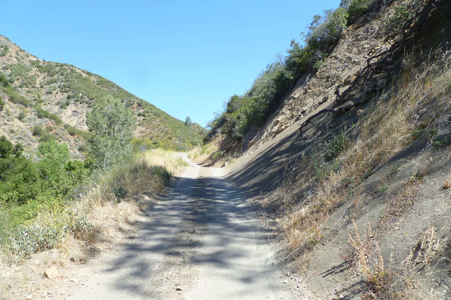
About mile 5, half way up the climb. LOTS of debris in the road. It's paved but relegated to near jeep-trail status at times. The grade is holding at about 10% here. Also the temp is hovering around 93F, which is still quite do-able. This is just past where I turned around on that ill-fated STUPID-HOT day 2 years ago. I'm quite stubborn apparently (I kept thinking it would get cooler as I climbed, until I finally figured out that it wasn't). It was in the news 2 days later that a college kid had died of heat-stroke climbing up from the other direction (they didn't find him until Monday). I guess I made the right choice to turn around when I did!

Now I'm past Cachuma Saddle (an intersection at mile 6) where I turn onto Figueroa Mt Rd and head for the summit. This shot is looking North at the jeep-road to Mckinley Peak. This is a great Mt bike ride, with a long and strenuous climb (ie, I LOVE IT!) It's about a 2 hour climb from the saddle, and about 20 minutes to descend. At the very top of the picture you can see the trail slanting across thru the trees onto the ridge. It gets hard from there.

Having now crossed over to the south side of the Figueroa Mountain, you can see the what all intrepid riders do: switchbacks galore, laughing at you hysterically (you've been climbing around an hour at this point). Keep on grinding, only about 3 miles to go!

Looking back down at those switchbacks. What a GREAT climb this is! Many pro teams do a winter training camp based in Solvang, and the Figueroa Mt loop is a mainstay of their training for the big European climbs. Back in the Postal/Discovery days Lance and company were here most every January.

Getting close now...though it's always nice to know for sure! Thank you whoever you are!

That's Figueroa Peak the arrow is pointing towards. The road goes around the peak on the right, passing roughly 50 or so vertical feet below the actual summit.

And here we are! Just ahead left of the dirt is the summit of the road. Altitude here is right around 4500'.

Down just a mile or so from the summit you break out of the trees to this view. The road sweeps around to the right, and other than the raging cross-winds is a BLAST to descend!

More wicked-fun descending. I love it when you can see the road sweeping out in front of you and can just let go of the brakes and scream! And screaming is also what you do when you get hit by HIGH crosswind gusts at speed.

Hard to see it thru the trees, but this is one of the many tight switchbacks going to the left. The pavement up here is still good, but it gets TERRIBLE for the last mile or so. But descending the other direction (on Happy Canyon, the way I climbed up) is MUCH worse.

Off the mountain, heading back towards Los Olivos on Figueroa Mt Rd takes you past the gates to Neverland (Michael Jackson's place). This is the front gates. There is a guardshack to the right and there's always somebody there. The family still owns the property, and you never know who might be there at any given moment.
From this point the road gently descends at about a 1 or 2% grade for the next 5 miles back into town. Oh, and did I mention that there's almost ALWAYS a tail-wind here? The road is running almost due-south, and with the exception of an incoming storm, our winds always come from the north. We've done pace-lines down this stretch holding speeds in the mid-twenties, which is pretty fast for a bunch of old-folk recreational riders. And it's an AWESOME way to end an epic road ride.
Last year I got a bit stupid and did a double-Fig loop one day, giving me 80 miles and almost 10,000' of climbing. Won't be doing that again anytime soon I can tell you. Once is plenty for one day I've decided. On this day I only saw ONE other bike on the entire mountain, which is quite unusual. It was a GREAT day!
Get out there and find an epic ride of your own! And keep the rubber-side down! And HAPPY FRIDAY to you!
Note: I added a link to the 2012 Tour Divide race (it's under my 'Link List' on the right below the blogs I like). This link takes you to the tracking page of all the racers in this years race, which started on Friday. It's a self-supported Mt bike race that follows the continental divide from Banff Alberta to Antelope Wells New Mexico. That's over 2000 miles of bears, rain, mud and whatever else Mother Nature throws at you.
Note: I added a link to the 2012 Tour Divide race (it's under my 'Link List' on the right below the blogs I like). This link takes you to the tracking page of all the racers in this years race, which started on Friday. It's a self-supported Mt bike race that follows the continental divide from Banff Alberta to Antelope Wells New Mexico. That's over 2000 miles of bears, rain, mud and whatever else Mother Nature throws at you.


