Sunday, June 21, 2020

Three Peaks Loop hike, Boulder

So yesterday (Saturday) we had the entire day off, Woo-HOO! It rained the prior two days, and then lo and behold Saturday dawned sunny, but not as hot as the previous sunny days last week...as in PERFECT for hiking! The guys at work had told me about a phone-App called All Trails, where you search for and find trails near you. You can then download the map right onto your phone, and then (with the annual paid subscription) simply hit RECORD on the app, and it puts your location on your downloaded map as you hike! (the free version lets you find and download maps, but it wont show you where you are on it). AND...it tells you pretty quickly if you are off-route! So I loaded the app on Friday and went ahead and got the annual subscription, and yesterday gave it a test. It worked pretty great! In fact, without it there is no doubt that I wouldn't have been able to do that hike...as I went off route a number of times and was steered back by the app (your phone has to have GPS reception enabled...which I found out doesn't work too well if you put it back in your pocket...however when I did pull it out and call up the app the GPS would sync quick and show me where I was). I was out nearly all day, and the weather was just perfect...T shirt, shorts, and my small travel backpack with 6 bottles of water and all the various food items I could scrounge up from my hotel room.

And so....here are some pics from the hike:

 The trail to the first peak (Green Mountain) quickly turned to rocks.


 This was new: a ladder over a near vertical bit. 


 A nice view of Boulder from the trail.


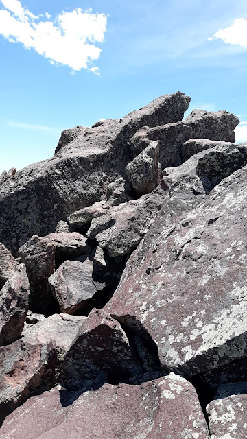
 Yep....lots and lots of rocks.


 The first of days three peaks: Green Mountain summit. After the trail being pretty deserted, suddenly it was like a party on the summit...I would have liked to climb up on the rocks for a picture but these people were really taking their time, so I just moved on.


 Here are the 2nd and 3rd peaks of the day: Bear Peak on the left, and South Boulder Peak on the right.


 Here you can see the trail going up to Bear Peak.


 From the trail to Bear Peak looking back at Green Mountain (the summit is the furthest little point on the left).


The trail to Bear Peak getting interesting. 

 
Yeah...this is actually a picture of the trail...pretty hard to follow as it looks a lot like all the other rocks around it.


 More rocks that are somehow part of the trail.


 Here you can see the degree of steepness as the trail switchbacks up to the top.


 And finally the final scramble to the summit up a knife-edge of rather slippery rocks. The other side of the rocks (on the right) is a vertical drop...did I mention I'm kind of afraid of heights? I stay well clear of the edge as I don't even like to look over the edge.


 Heading down off the summit peak...the entire top was quite steep on all sides.


 This shot shows the knife-edge of the peak a bit better. You actually walk right on that rock in the middle of the picture...and you do NOT want to slip.


 Now I'm heading over to peak #3: South Boulder Peak.


 The trail between the 2 peaks is wonderful. Here I'm looking at South Boulder Peak.


 Nearing the top of South Boulder. Here the trail is gone, you just scramble over the rocks anywhere you can.


 The highest point of the summit. Again, a sheer drop lies on the other side of these rocks.


 Looking back across to Bear Peak (just to the right of the dead tree) and Green Mountain (the distant peak to the left of the pic).


 The only selfie I took the entire hike: on the South Boulder summit with Bear Peak just over my shoulder.


 Looking back up at South Boulder Peak. Not much there but a bunch of rocks.


 Looking down at the Devils Thumb rock formation (center of the picture). This view is in between the two final peaks.


 On the Shadow Canyon trail headed down. The trail is great up here, a real yellow brick road!


 A better picture of the Devils Thumb rock formation. 


 The Shadow Canyon trail has turned ugly...rocks rocks rocks, with some pretty huge stepping down required. I quickly found a hiking stick to help with the descent...which is only a bit over a mile, but felt like much more to my old knees.


 The trail is somewhere in this picture. Its not pretty I can assure you. My knees were not happy.


 The trail of tears (from me at least).


Here they put railroad-ties with notches cut out to help with the steep slippery rocks spot.


 Another cool rock formation (don't know the name of this one). Here I'm down off the Shadow Canyon descent with about a 4 mile hike back to the start remaining. 


 Another view looking back at that rock spire. Its really pretty in here.


 Looking back, the Shadow Canyon trail is on the far side of the mountain on the left of the picture.


And finally I'm nearing the end, total mileage 14.5, just under 7 hours moving time, with just under 5000 feet of climbing. And two very sore knees. I can go up all day long, but the down kills me! But I survived, and it was a rather epic day with perfect weather. Not a bad way to spend a day off.


Wednesday, June 17, 2020

Colorado Rocky Mountain High

Well...I'm here in Boulder. Its pretty nice actually...I was a bit scared to be traveling right now, but here in Boulder at least they get it. Masks everywhere, people polite and keeping their distance, restaurants open but at limited capacity...pretty much the textbook of how we should be operating right now. We are working 2nd shift thru next Tuesday, getting off work around 2am. Yesterday and today I went hiking somewhat early (9am)...lots of cars parked at the trailheads, but everybody is WAY spread-out, and nearly everybody has masks with them and we pull them up when we pass...everybody is very polite too. Its pretty cool actually!

So yesterday I hiked Flagstaff Mountain (same hike I did a year ago when I was here...same place I saw the bear running down towards the trail...alas there was no bear this year). And then today I hiked the Chautauqua trails to the Royal Arch. Here are some pics from the hikes. First up are the Flagstaff Mountain trail shots.

 Looking up at Flagstaff Mt from the bottom. It doesn't look like much in the pic but its a good 1500ft to the summit, and a lot of rather steep hiking.

 From the summit looking back into the mountains behind Flagstaff...  the REAL mountains.

 Looking down over Boulder.


 The old Stone hut at the top, built in 1930 I recall (from the signs).

 Near the summit suddenly there were flowers. These are poppys I believe.

 And here are some orchids in with the popppys. Wonder if these just grew 
here naturally, or did someone plant them.

 Another view of Boulder.

 Looking across the valley as I descend....towards the Flatiron Mountains.


 And yet ANOTHER view of Boulder.

And then from today, pics from the Royal Arch hike in the Chautauqua Trails park:

 The Flatiron Mountains. My destination is at the far left and back of that mountain.

 It was a real yellow-brick-road in the lower sections of the hike.

 Here is where it started to get interesting.

 The last mile up had a ton of rock-hiking. Somebody did a LOT of work to make this trail!

 More rocks and stairs.

Hard to believe THIS is the trail!


 And finally...the Royal Arch! It was awesome, well worth the effort! 
(the arch is right at 2.25 miles from the trailhead).

 Pretty awesome to find this up here. How someone ever found it in the first-place is beyond me...
the trail getting here was pretty intense!

 Looking up at the arch. It looks like the 2 stacks of rocks just fell into each other and there you go.

 And a different view of Boulder.

 Descending was much harder than the climb. One false step or slip and you could be hurt pretty bad.

 Did I mention how much work it must have taken to make this trail? WOW!

And finally looking back up at the Flatiron rock-slabs. Pretty awesome park they have here!

And that is all for now...I hope to hike whenever I have time off during the day AND when my knees aren't too upset (they were a teensy bit angry today by the time I got back to the car).