So as I alluded to a few weeks ago, I recently went on a road-bike tour from Crescent City (CA) to my home in Santa Maria with my brother Greg. It was at the Crescent City airport that we ended our Tour of Oregon Coast last year, so it was fitting that was where we began this ride. Oregon was 8 days of riding covering 400 miles, and California was 13 days (and we didn't actually do the entire state). We simply didn't have enough time, and neither of us really had any huge desire to go thru/around Los Angeles/Long Beach. As it turned out, day 13 brought us right back to my house just as a week-plus long heat-wave was hitting the west. Had we continued south it would have been horrible. Some things are simply meant to be.
But anyway, this will be a story told in pictures. There is no better way to REALLY SEE an area than to ride bikes thru it, easily stopping nearly any time to take whatever picture takes your fancy. You can't really do that by car. And touring by bike really gives you a much better connection with the trip as it's what you do nearly all day, schlepping a very heavy bike the entire distance.
I'll start each days photos with the STRAVA map of that days ride. STRAVA, for those of you who have never heard of it, is basicly a Facebook type thing for athletic endeavours. It is GPS based so it shows not only where you did your thing, but it calculates mileage and altitude among other things. It also shows what pics I took along the way at the point on the map I took them (a pretty cool feature of STRAVA, as you can see below in the map) and at the very bottom it also shows the altitude profile of the route. This is all web-based, so at the end of every ride I upload my ride to STRAVA, and then all my 'friends' who follow me can see my ride (and I can see their activities too). I've added in the actual mileage and climbing for each day below the map, and also how long it took us to do the ride (actual moving time, not the elapsed time...being as this is a vacation we have LOTS of not-actually-riding time every day). And so, let the story begin!
Day 1: Crescent City to Elk Country RV Resort & Campground

Day 1 stats: 49.13 miles, 3117' climbing, 4h 5m moving time
As you can see by the altitude profile, we have a pretty good climb starting 5 miles out of Crescent City...game ON!

Here I am, ready to roll on DAY ONE! It's a pretty exciting thing to have NOTHING to do but ride my bike all day, every day (for the short-foreseeable future). I'd call it a taste of retirement. I weighed the bike at home before I loaded it in the rental car, it was right at 60lbs with empty water bottles. So it's a bit heavier than that, but still WAY lighter than last year for the Oregon trip (I recall it was 72lbs at the start).

Here is my brother Greg not too far into the ride. Notice the sun-beams penetrating thru the redwoods.....yes, redwoods! I hadn't realized how quickly we would be into them, somehow I thought they were further south. This is the Del Norte Coast Redwoods State Park we are currently in. Riding in redwoods is AWESOME!

Parked my bike at the base of one of the mighty trees, took the shot in widescreen mode. THAT is a BIG TREE! (widescreen mode doesn't really do it justice).

As we rolled thru the tiny town of Klamath we couldn't help but be lured into the parking lot where Paul Bunyan and his blue ox Babe reside. You can see how big they are by the size of my bike parked by Paul's right foot. Interestingly enough, Paul starts actually talking to us as we roll in and park our bikes! I have no idea where the guy talking is actually located, but he is asking us questions and talking to any who venture anywhere near him (and he hears our talking back to him, so it's an actual conversation). When we mounted our bikes to roll-out he said goodbye,and his right hand was waving bye-bye to us. Very cool!

A little insight into just how big Paul really is. We have no idea just what the "Trees of Mystery" are all about (that's what Paul and Babe are here for, to lure tourists and their $ into that area). Maybe next time....we have places to go and people to meet.

Here I am posing at another humongous tree. No traffic, redwoods...riding thru this just doesn't get old.

And an even BIGGER tree!

Ahhh...now it makes sense.

Here we are at our campground for the night: Elk Country RV Resort and Campground. As we roll thru the park looking for our site we pass this. You just don't see an RV and Cooper Mini all decked out in matchy-matchy paint and stuff (looking closely at them it's not all just paint....there are lots of 'things' actually glued to them both creating the look. I'm guessing neither goes very far these days...who knows how long the RV has been parked here).
Our campsite for Night 1. I tried to get campsite photo every day but sometimes forgot. Helps to put the campgrounds we stay at in perspective (which ones were nice/etc). As the campground name suggests, there are lots of Elk in this area. They apparently cruise right thru the CG pretty much daily, but sadly we missed it as the herd cruised thru earlier in the day, and we will be leaving before they cruise thru tomorrow. Rats...that would be pretty cool to have a herd of elk walking around the campground!
End of day 1 totals:
49.3 miles, 3117' of climbing (counts Day 0 miles/alt)
Day 2: Elk Country CG to Riverwalk Campground, Fortuna

Day 2 stats: 58.46 mi, 2323' climbing, 4h 26m moving time

So this is a shot I took as we were departing the campground in the morning. To me it has kind of an Alaska-vibe to it.

This is Big Lagoon, not very far from the start. Just beautiful, to me it looks like a lake up north somewhere (Minnesota comes to mind). It's a beautiful day for a bike ride!

Now we are back near the coast just north of Eureka. That's a small Coast Guard Cutter in the shot, the crew had the engine running and was just getting ready to head out.

Our campsite for Night 2, Riverwalk RV Park & CG in Fortuna. Turns out that just behind us is the road we came in on, and there is also a large truck-stop not far away. So apparently that little road turns into some kind of a racetrack at night for wanna-be racers, and also the big rigs like to use it with their oh-so-quiet diesel engines. Not that we needed a reason to not sleep well...but we sure had it here.
I was planning (hoping) to do a little side-excursion after we made camp...it was to ride west thru Ferndale out to the coast to what was a Naval Station (Centerville Beach) back in the 60's,70's and 80's. I was never actually stationed there, but it was one of the SOSUS sites on the west coast and I had been there several times over the years in my various Navy duties. On the maps it's listed as "Old US Sub base" which is hilarious. The locals all believed there were actual "sub pens" like Germany had in WWII, where their subs could go inside mountains to hide from our aircraft (think of the scene in the Harrison Ford movie "Raiders of the lost Ark").
I believe all the buildings have now been torn down, but I wanted to see the site and reminisce...Centerville was the premier site on the CONUS west coast for many years. Alas, it would have been 15 miles each way from our campsite, and we both decided NOT to add 30 miles to our day. Now that the trip is over I wish I had gone ahead and done it. Just cruising thru the small quaint town of Ferndale again would have been fun (it's a really neat little town)....Ferndale would have been about half way to the Navfac site from our camp. Oh well...that ship has sailed and I missed it. Maybe opportunity will show up for me one day.
End of Day 2 totals:
107.76 miles, 5440' of climbing
Day 3: Riverwalk CG to Richardson Grove State Park, Huckleberry Campground

Day 3 Stats: 60.63mi, 2730' climbing, 4h 46m moving time
(for some reason the pictures I took today didn't show up on the STRAVA map where I took them).

Getting ready to ride early (for us) in the morning. This is our solar-array situations...we use the arrays to charge battery-banks so we can recharge our electronics at night. Mine on the left is a 3-panel 10 watt array, and Greg's is a 2 panel 9 watt unit (from Harbor Freight)...he had problems with it the entire trip, we've no real idea why.

Back to the redwoods, NICE! Today is all inland (as you can see from the map). We rode away from the coast yesterday afternoon after passing Eureka. We are about half-way thru today's route already at this shot.

Zooming in on the map from the last picture.

Now THIS is what I'm talking about! We have 32 miles of redwoods today! And, there was almost NO TRAFFIC! It as just an amazing day on the bike! I was really looking forward to this part of the ride ever since I mapped out the route weeks before.

Forgot to take this shot on the way in to the campground, so we actually took it on the way out the next morning. Turns out it SHOULD be called "Mosquito Grove State". They are already tearing into me in this pic (at just 8am), and it was way worse inside the grove last night...they were biting me thru TWO layers of clothes! These are like saber-tooth mosquitoes!
End of Day 3 totals:
168.39 miles, 8170' of climbing
Day 4: Richardson Grove CG to Mackerricher Beach State Park CG

Day 4 stats: 56.72mi, 5141' climbing, 4h 56m moving time
(another day where the pictures don't show up on the map, all except for the very last sunset shot).

So this shot has no real meaning here in our epic-road-trip pictorial, other than for me to give you a very short synopsis as to why I thought this pic worth taking: a long time ago (in a galaxy far far away...Helena Montana) when I was just 10 years old, our little band of hooligans (me, Bobby Cole, my little brother Dave, and Bobby's little brother Raymond) 'FOUND' an orange crane very similar to this one just sitting there, abandoned (sitting inside the fence of a junkyard, ie, not abandoned at all). We crawled thru a hole under the fence as kids do, and swarmed over it like ants. Inside the cab there happened to be a toolbox full of tools.
One thing led to another, and before long we were taking the crane apart bolt by bolt and laying the parts we removed out in the sand in a nice organized layout (like we are going to make a parts diagram for the crane). The crane we found still had the 'boom' attached, which is missing from this crane (I mention this because the boom is how we got caught).
I digress...We came back every day to continue our summer vacation 'jobs', right up to the day the man with a shotgun showed up, and we ended up at the Sheriffs office. Greg had not been with us to the 'job-site' until that day when I had finally coaxed him to come out and "see what we had found". When we arrived at the job-site that morning with Greg, I immediately did my best 'monkey-boy' and climbed pretty high up the boom.
Turns out that's when the junkyard-man saw me (I was now visible above all the junk cars and such), called the cops, and then showed up with his gun. When the deputy's arrived at the scene of the crime, they figured Greg (obviously the oldest) was the ringleader of this criminal organization, even tho he had absolutely noting to do with the vandalism (I like to call it "work we had performed") The junkyard man with the shotgun wasn't impressed whatsoever with our handy-work...but we were just being kids with tools. It turns out that taking stuff apart is something I'm rather good at.
Down at the Sheriffs office they used my being out on the boom as the reason they brought us in (our safety...had I fallen I could have been killed they said...tho thinking of all the trees I fell out of as a kid I can't really concur w/ their logic, i wasn't really that high up). I can only assume that after Mom had picked us up from the station that they all laughed good and hard at that one.

So this shot shows the pretty obvious dead-end that "RideWithGPS" (the route-building website that I used to build our daily routes) thinks is a road that goes thru. Obviously not, and we were several miles from where this little side-road detour started.

So here is Greg bushwhacking his heavy ROAD BIKE up what we decided was a 'shortcut' (rather than to ride back several miles to the actual intersection). The road we need to be on is just at the top of that seemingly short slope.

Here is a better view of the 'shortcut' as Greg makes his own switchbacks to the top...it's much harder than it seemed from that last pic I can assure you. (I took a different route off to the right and beat Greg to the top, which is how I was able to have a pic of him starting the shortcut ahead of me, and then looking down at him still struggling with a very heavy road-bike thru the weeds).

So this very scenic picture is not very far away from the last three shots...in fact, we were just on the other side of that little hill just to the right of center. There was a very rugged dirt road gong down towards the water (that we briefly thought of trying...glad we didn't, we had no idea what lie around the corner as we were trying to figure out how to get back to Hwy 101).
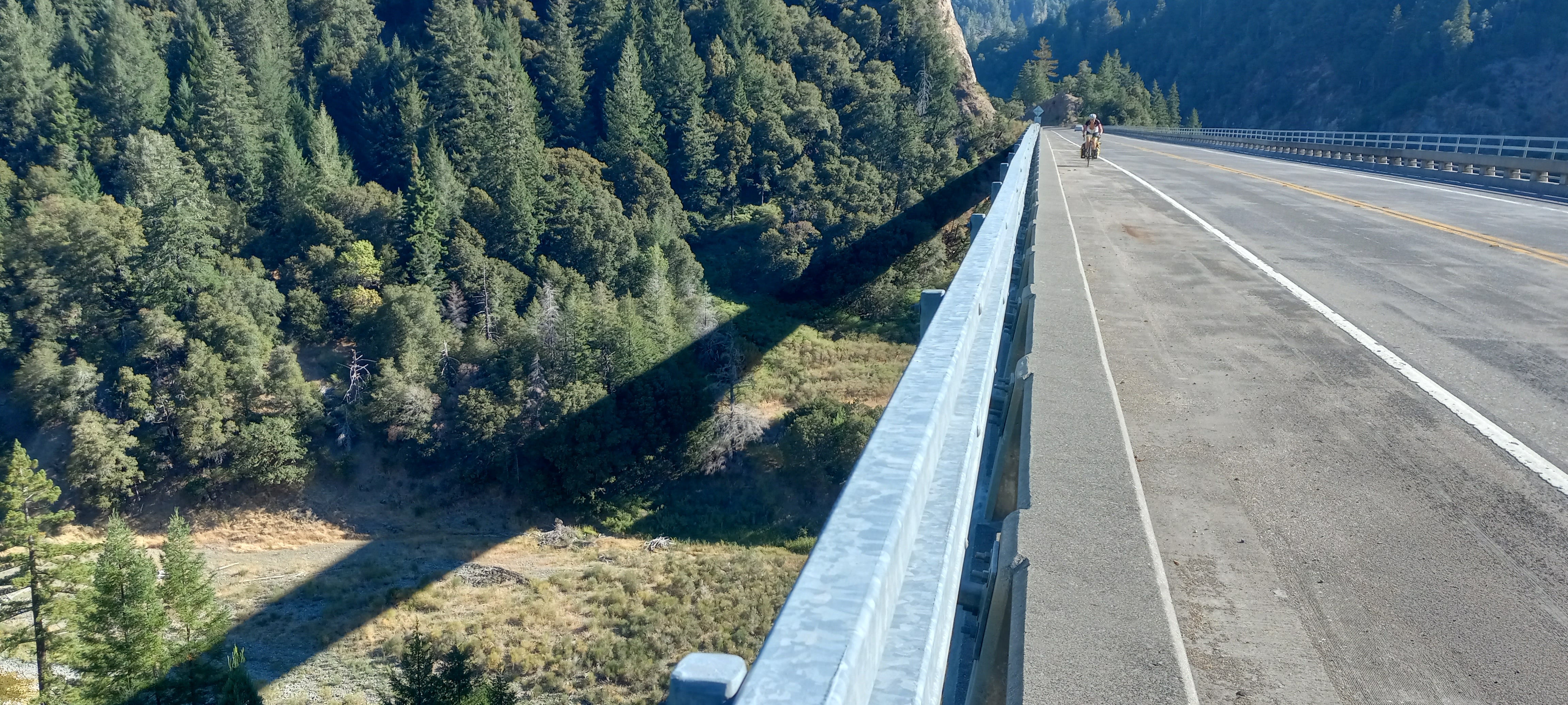
Pretty much the same spot I took the last pic from, only now I'm just looking back at Greg coming up on me. Also note the wonderful shoulder on this beautiful bridge! It's actually pretty high up, but the side-rails are plenty high and it wasn't scary at all (mostly due to aforementioned shoulder). Most bridges aren't nearly so nice (and not-scary) for bikes.

Here's where we rejoined the coast, about half-way thru today's route. The turn away from the 101 back at at Leggett (around mile 18 on the maps altitude profile where you can see the climb starts) was where things got interesting...it was a pretty long climb thru the trees on some very good road surface, I really liked it! At the top there was some road construction and 1-lane for a short bit (with the flagman) and then we had a very sweet 10+ mile winding descent on some pretty great pavement! I really enjoyed that part...my all purpose bike really does well loaded with gear descending at a pretty good clip (and climbing, and flats too). And the traffic since we left the 101 was almost non-existent!


And we are there....as much as riding all day is wonderful, it's always quite a nice feeling to be at the end of the days ride.

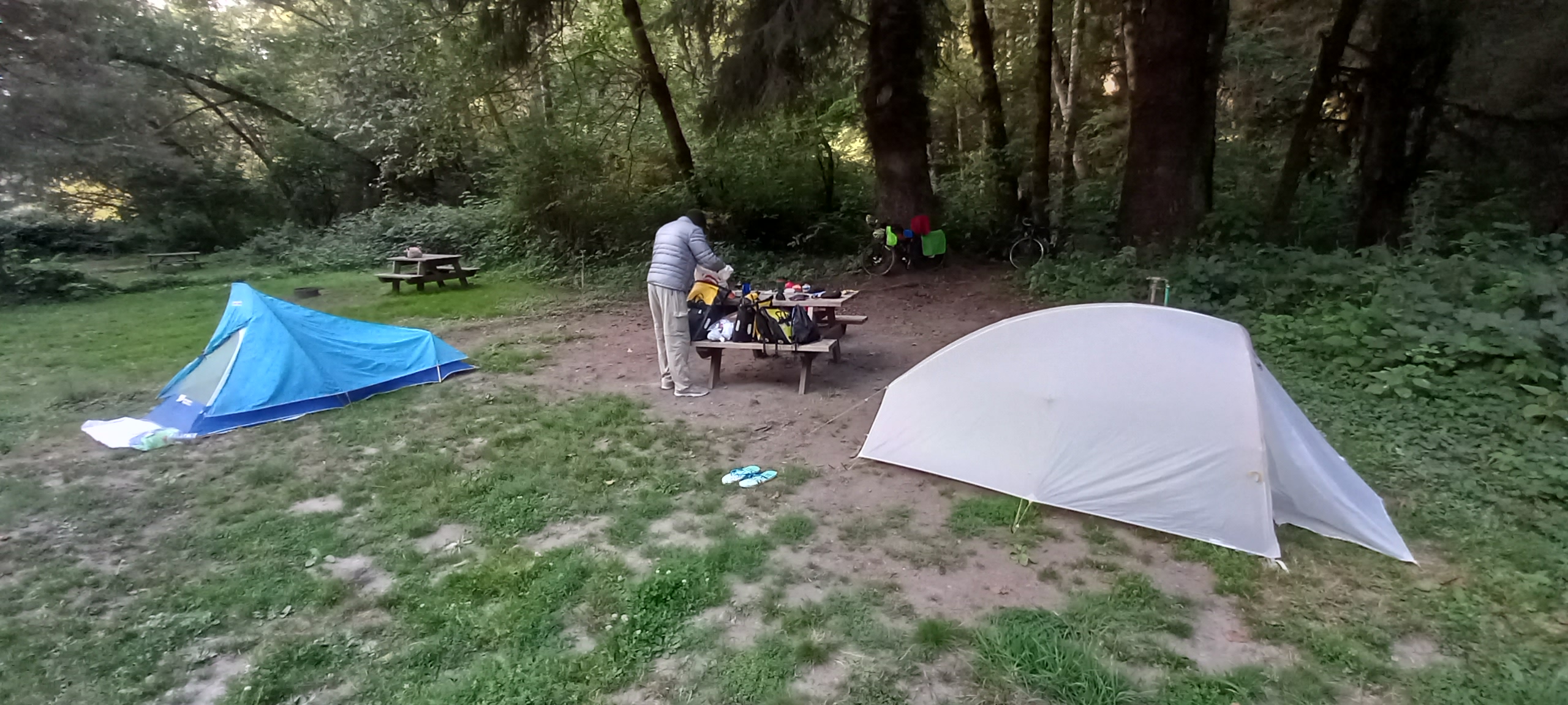
The campsite for tonight. I can't remember which day we were on when we came across 3 other riders heading south. I recall that for the first few nights of our trip we had the hiker/biker area all to ourselves (notice how far we spread out here...I'm the white tent on the left). Pretty sure the other group was leapfrogging us along the route by this point (their names were Zoe, Nic and Matt....and I am sad to say I didn't take any pictures of them).
Basically we like to get our tents as far apart when possible, just so we don't keep each other awake all night as we both do our usual tossing and turning, cuz no matter what sleeping-pad we have, sleeping on the ground at our age just isn't very comfy. Greg's 4" thick inflatable pad is much more comfy than my 2" pad (but mine is much lighter). We both had bought the 4"ones for the Oregon trip last year, which is partly why my bike was SO heavy on that trip. Cutting weight, whether from my bike or backpack, is always a tough thing...it always comes down to the question "how comfy do I want to be and what am I willing to go without"? That is always the hard question.

Day 5: Mackerrricher Beach CG to Gualala Point State Park CG

Day 5 stats: 68.64mi, 5075' climbing, 5h 53m moving time
A LOT of today's pics didn't show up on the map (again). Odd...I took a bunch today too. (Note: today is a pretty big day mileage and climbing wise...one of the hardest).

Morning on the coast, just fantastic! We were in and out of the mist a lot today, and the route was pretty much death-by-1000-cuts (or little hills in today's case) as you can see by the altitude profile.


A nice view from the bridge over a neat little bay (not sure what it's called).

Views like this are starting to become the norm. Much similar to the Oregon coast IMO.

Here we are on a side-trip/excursion to a lighthouse when we came across all these deer just hanging out in peoples yards. Pretty nice area here.

And here it is...Point Cabrillo Lighthouse.

The view from the front. Quite a nice little lighthouse, tho the construction (IMO) looks more like a church than a lighthouse. Put a big bell up where the light is and presto.

Here was a neat little area for pictures...our road takes a 45 deg turn and goes over that bridge you can see peeking out thru the trees.

Here's a shot from closer to the bridge...that little bump is Greg riding across, he's just about in the middle.

Ahhh yes....back in the layer. But you can't deny how beautiful it is along the coast.

What was I just saying? Oh yeah....beautiful!

These views (like riding in the redwoods) just don't get old!

Running out of things to say about the views....go ahead and add your own.

Just what a heavy-bike touring rider wants to see....switchbacks up a serious climb (the climbs never bothered me....my bike is geared WAY LOW and not quite as heavy as Greg's). And it may not look like much, but those switchbacks are about 18% grade, which is HUGE even for a non-loaded bike. Also, at this point in the ride Greg's shifting wasn't working so well, and I recall he couldn't even use his granny gear. THAT would be tough!

Looking back, the tiny town of Elk is back on the top of that little bluff. We saw our 3 leapfrogging riders sitting there at a cafe and they waved at us on our way by....I think tonight's camp is the first time we all stayed at the same campground. We have been doing longer days than they were, and we also get up and moving earlier. Last night they stayed in Fort Bragg (about 10 miles past Mackerricher Beach where we stayed)...but now our campsites and daily distance have finally caught up with each other.

Wish I knew the names of all these scenic little spots. I'll just call this one "nice view # 1,257,983.
End of Day 5 totals:
293.75 miles, 18,386' of climbing
Day 6: Gualala Point to Bodega Dunes State Park

Day 6 stats: 47mi, 3930' climbing, 3h 49m moving time
(I think this is the shortest day of our trip).

Once again we start off our day in the marine layer (I'm pretty much used to that). The old saying is "if you're not cold at the start of a ride then you're overdressed".
I don't think I was EVER overdressed.

Around a corner and we come upon this old Russian site: Fort Ross. I'd never heard of it before, tho I do know that Russian fur traders were quite active all along the west coast back in the 1800's.

A little something about the Fort.

The view of the fort from inside (as seen from a bat hanging upside-down). I've tried to get this pic to flip 180 deg several times now and have given up. If you're looking at this on a phone or tablet it's easy...just flip it. On a computer-monitor, not so much.

Continuing along the coast in and out of the layer.

Greg rounding a corner near the top of a climb.

You can plainly see where the layer ends...when the road goes inland just a few hundred feet we get into the sun, then back towards the water we are back under it. Today's ride is totally along the coast, not counting the to/from shore bits as the road rolls along south.

Pretty amazing little bay....the coast along here is just amazing!

Greg taking a picture of another little bay.

There's a lot of rocks in the water along these-here-parts!

And finally, our Day 6 destination.
End of Day 6 totals:
340.75 miles, 22,316' climbing
Day 7: Bodega Dunes to Samuel P. Taylor State Park

Day 7 Stats: 42.19mi, 3415' climbing, 3h 42m moving time
(Another day when the pics didn't show up on the map).

This is the beginning of Tomales Bay (the water off in the distance in the left-half of the pic) and also shows the start of Point Reyes National Seashore far off on the right side.

So this picture was a sad one for me....it's the 'cockpit' of my bike. The silver Garmin 500 (on the left with 8 data screens), the Garmin 810 (in the upper right with the Navigating map running tho it's hard to see), and my SPOT (Satellite POsition Tracker) in the bottom right of the pic. The upper right data field of the 500 shows 20.8 miles, and the left data field of the 810 also shows 20.8 miles.
What that means is the 500 shows how far we've gone today, and the left field on the 510 shows how far we have left to go today. So this picture is the exact middle of this trip (the middle of the miles on day 7 of a 13 day trip). Knowing the moment when this awesome vacation was officially half over really hit me...it's been so fun getting up every morning knowing all I have to do every day is ride my bike! From this moment on every mile is counting down on the other side of the half-way point.

Here I'm past Tomales Bay and the town of Pt Reyes Station, and nearing the left-turn that takes us to the campground for the night.

And hooray...we are at the campsite.

So we had our clothesline strung between 2 trees (redwoods) and the camp host came by and said we aren't allowed to tie or hang anything to/from the trees...so we got creative and stretched our line over the little shacks roof (on the right of the pic) to the raccoon box (can barely see the left side sticking out between the 2 trees on the left).
The clothesline is an important part of camp-life every day...we get up and leave early so we can get to camp early enough to take showers and wash our riding clothes from that days ride, and then hang them out to dry somewhat before we pack them away. Unless we have good sun for a few hours and/or no chance of dew or marine layer, we take all the stuff down before we sleep. Otherwise it will be wetter in the morning than it was when we hung it up. Several mornings we end up putting on a 'wet' kit to start the days riding (which makes it feel even colder when we are starting n the layer).

This 'insane' RV was in the spot next to our hiker/biker site...had to take a pic of it. It's an "Earth Roamer XV-LTS". Had to look it up on the internet...it's custom made in Denver on a Ford F550 frame. Cost: OVER half a million buckaroos! YIKES!!! That's CRAZY!! It's got more than 1 alternator, a generator, 100 gallon diesel tank, a bank of batteries, solar arrays, Satellite TV and satellite phone...this thing is totally meant to get you out there off the grid in comfort and style. If I had a cool 50 mill or so lying around I would TOTALLY consider owning one of these! Maybe even as little as 40 mill! Yep...I think if I had 40 mill lying around I would most definitely maybe have one!
End of Day 7 totals:
382 miles, 25,731' of climbing
And that ends Day 7of our 13 day ride. Stay tuned for Part 2!
No comments:
Post a Comment